Follow me:

Date posted: December 29th 2016
Book Title: Washington - A Life (Part 2, pictures)

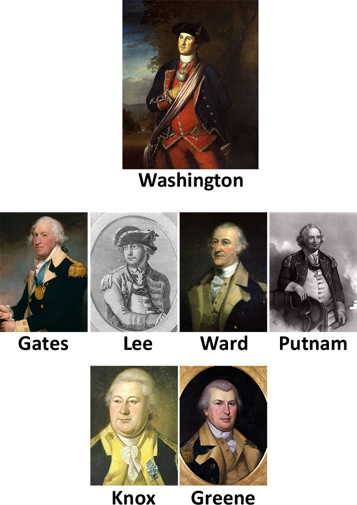
Portraits of some of the Generals under George Washington.
At the top, George Washington (age 40) is wearing his old uniform from the French and Indian War.
All images under Public Domain via Wikimedia Commons
-
Notice that this is the same face that we saw in an earlier painting after the Fortification of the Dorchester Heights. Is also the same painter. Copy‑paste much?↩
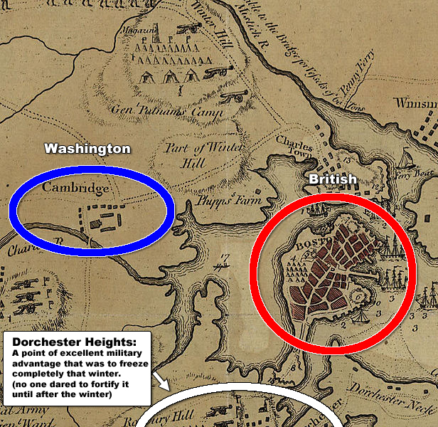
A map of boston back then. Washington’s headquarters were located in Cambridge and the British were all in Boston.
To the South we have Dorchester Heights, a place that will become important later
Image under Public Domain via Wikimedia Commons
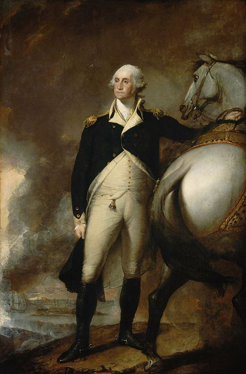
Somewhat of a sad-looking Washington despite his first (casualty‑free) victory.
This was painted in 1803 (many years after the war)—which is why he looks so old—I guess people already remembered him as the old dude that still comes to our minds when we hear Washington. Hopefully after you read this your image will change.
Image under Public Domain via Wikimedia Commons
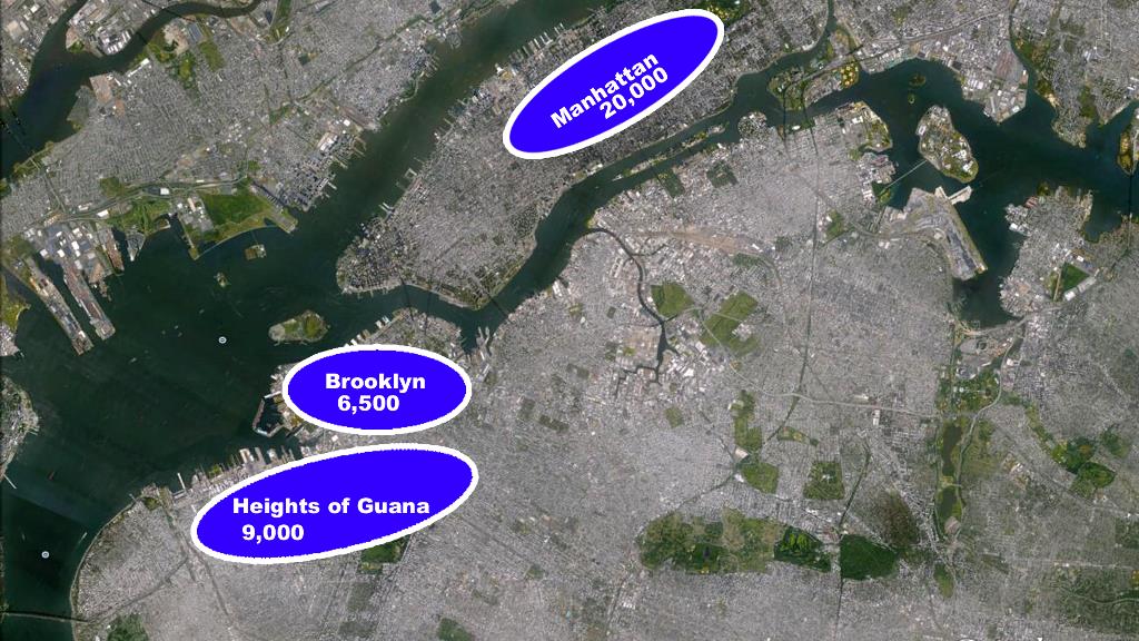
Washington’s position before the Battle of Long Island
Map by Google Earth
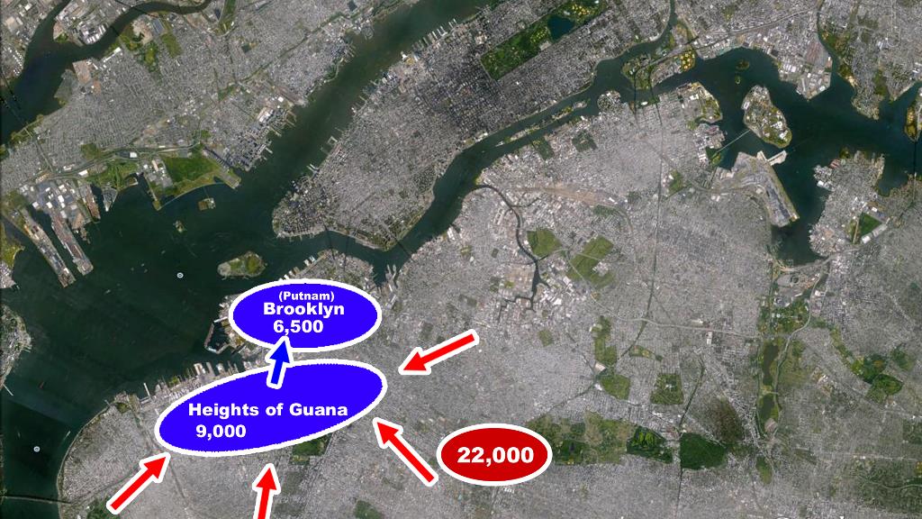
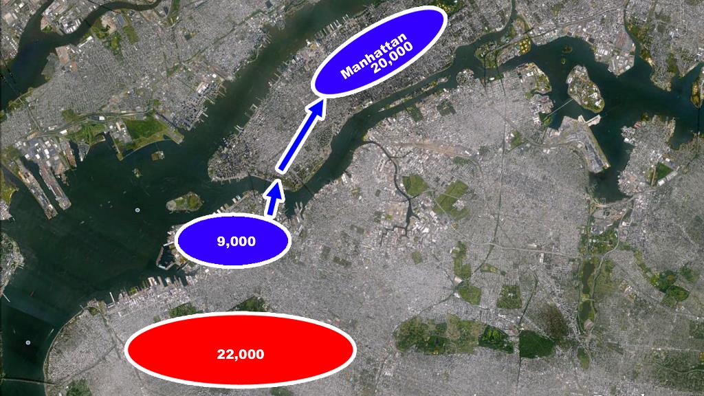
The Battle of Long Island, where the British outnumbered and outsmarted the Continental Army.
Map by Google Earth
Retreat!
Map by Google Earth
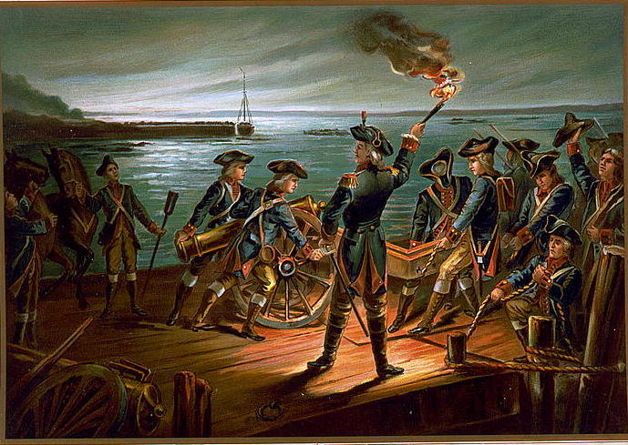
Retreating to manhattan in the middle of the night.
Image under Public Domain via Wikimedia Commons
.jpg)
The landing at Kip’s Bay
Map by Google Earth
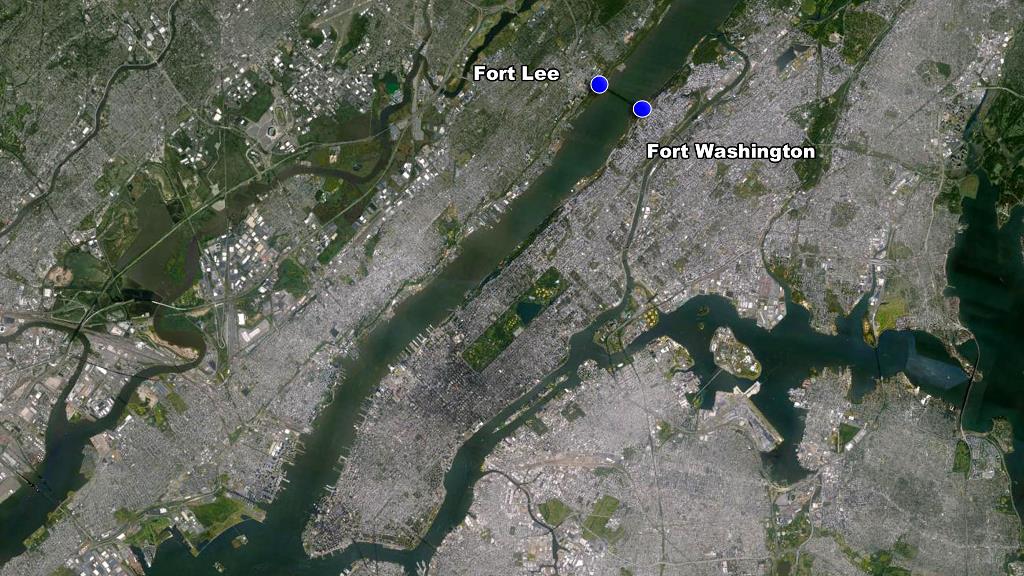
The locations of Ft. Washington in North Manhattan and Ft. Lee across the river on the New Jersey side.
Map by Google Earth
Retreat to Philadelphia.
Map by Google Earth
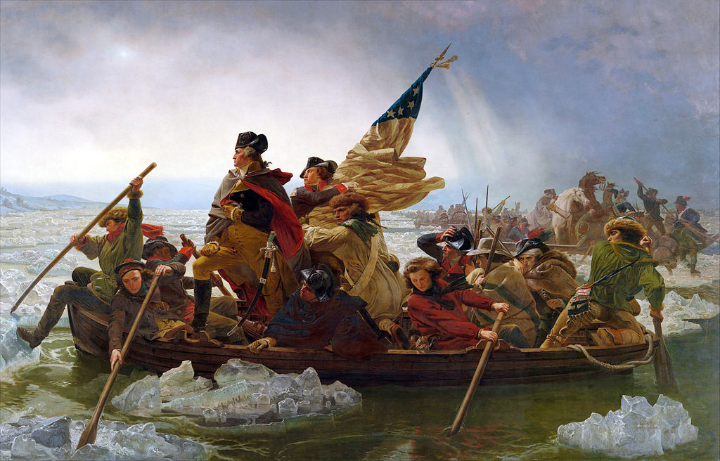
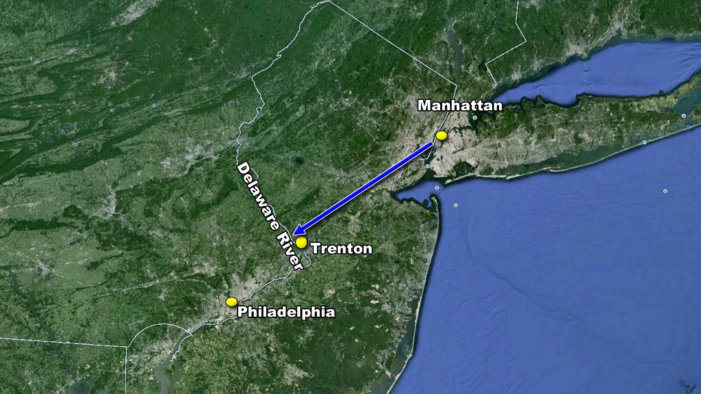
One of the coolest paintings and best moments of the American Revolution. Washington Crossing the Delaware back to New Jersey to attack the British encampment in Trenton.
Image under Public Domain via Wikimedia Commons
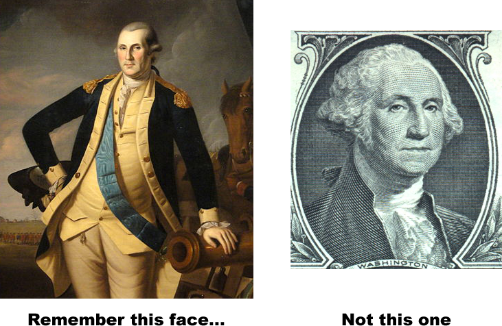
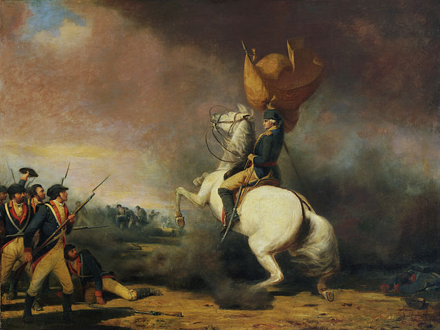
On the left, the badass‑looking “George Washington at the Battle of Princeton” by Charles Willson Peale.
On the right The not‑so badass‑looking “George Washington” by Gilbert Stuart. 1
Left and right images under Public Domain via Wikimedia Commons
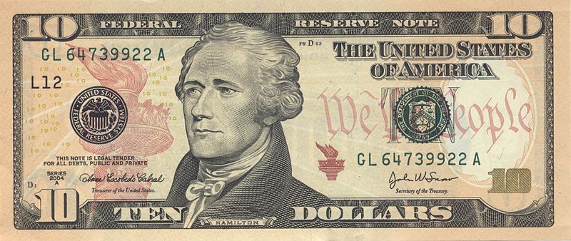
A ten dollar bill showing Alexander Hamilton’s portrait based on an 1805 portrait by John Trumbull.
Image under Public Domain via Wikimedia Commons
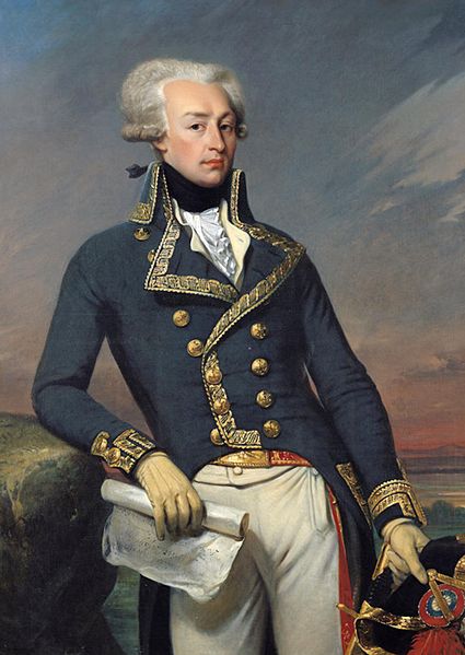
The Marquis De LaFayette as a Lieutenant General, 1791. Portrait by Gilbert Motier.
Image under Public Domain via Wikimedia Commons

The British landing at Chesapeake bay and moving up towards Philadelphia, intercepted at Brandywine.
Map by Google Earth

The battle of Brandywine.
Image modified from an original under Public Domain via Wikimedia Commons
.png)
Three scenarios of how the ‘Rebel Spirit’ chart could go.
chasanabria.com
You may need to enable the “unsafe” scripts that your browser is blocking to see the zoomable image below
The events and their moral impact up to the battle of Brandywine.
chasanabria.com
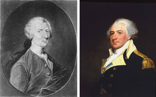
Thomas Conway (left) and Thomas Mifflin (right). We have already met the other two involved in the Conway Cabal, Gates and Lee.
Left and right under Public Domain via Wikimedia Commons
Three new events added. Germantown, the winter of 1777, and the Conway Cabal. This whole time the Rebel Spirit was dwindling and falling dangerously low. The discontent was finally manifested in the Conway Cabal.
chasanabria.com
Baron von Stuben
Image under Public Domain via Wikimedia Commons
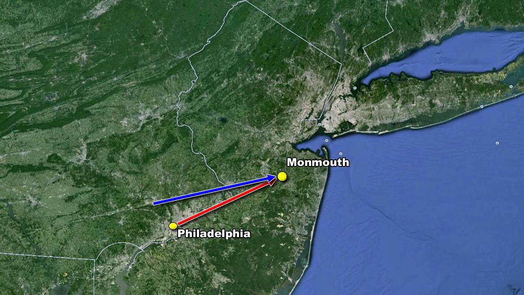
The British retreated to New York after the French announced their alliance. Washington didn’t waste time and chased them up New Jersey, catching up to them in Monmouth.
Map by Google Earth
Five new events added. After the French alliance there was a period of relative boredom for Washington in the North. The boredom was interrupted by the Capture of Stony Point by Mad Anthony.
chasanabria.com

“Mad” Anthony Wayne
Image under Public Domain via Wikimedia Commons
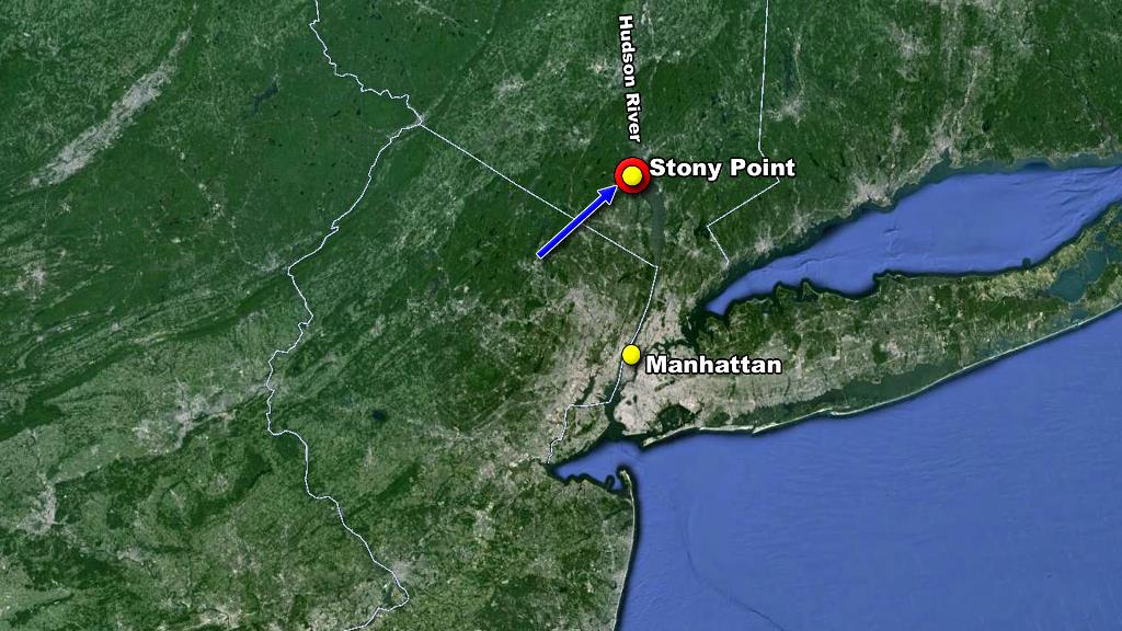
Capture of Stony point by Mad Anthony.
Map by Google Earth
One winter and two terrible losses added to the chart.
chasanabria.com

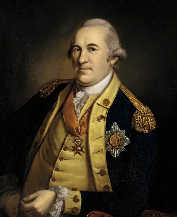
Benedict Arnold
Image under Public Domain via Wikimedia Commons
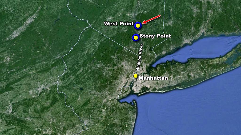
The location of West Point, a fort that Arnold Benedict was about to hand over to the British.
Map by Google Earth
Three events and one winter added. Mad Anthony to the rescue!
chasanabria.com
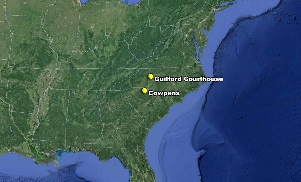
Two important victories in the South by General Greene.
Map by Google Earth
Three victories added including Yorktown (which we will talk about in the next page), this was the battle that changed everything.
chasanabria.com
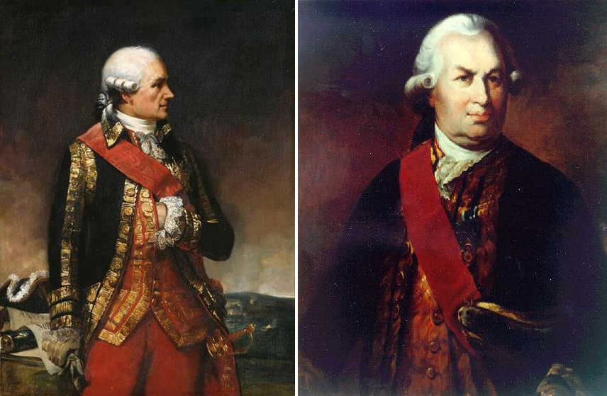
Marshal Jean-Baptiste Donatien de Vimeur, comte de Rochambeau (left), commander-in-chief of the French Army. And François-Joseph Paul, marquis de Grasse Tilly, comte de Grasse (right), admiral in charge of the naval fleet
Left and right under Public Domain via Wikimedia Commons
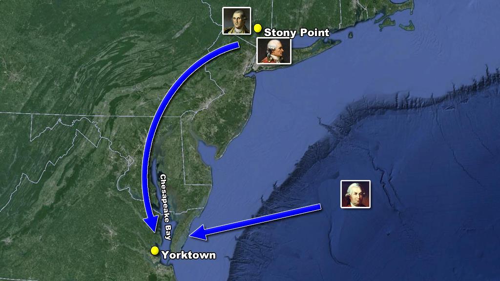
Moving towards Yorktown.
Map by Google Earth
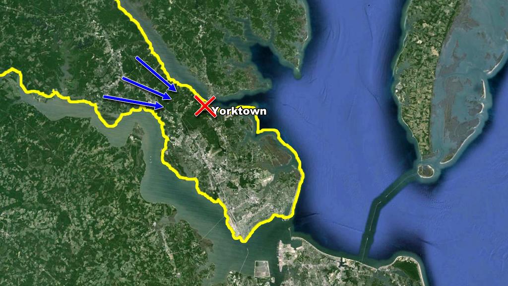
The precarious situation for any fort built in Yorktown.
Map by Google Earth
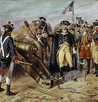
Washington firing the first cannonball of the day on October 9th at the Siege of Yorktown
Image under Public Domain via Wikimedia Commons
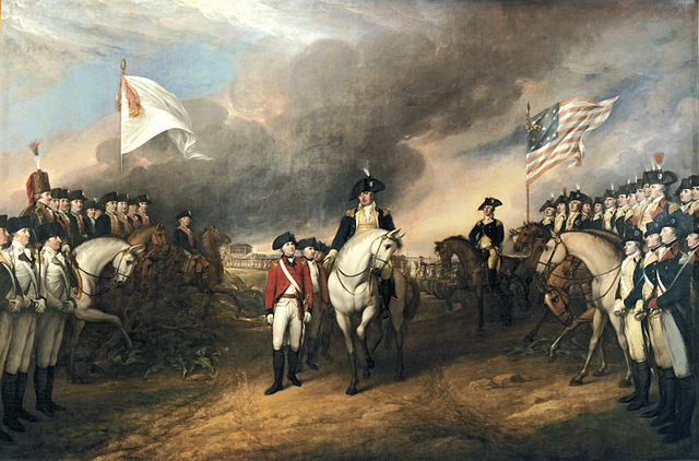
Defeated British soldiers walking through a double column of American soldiers.
One thing is for sure, they did not look as nice as they do here, it was well recorded that the americans looked like a bunch of hobos next to the spotless French soldiers.
Image under Public Domain via Wikimedia Commons
Recognition of independence and peace treaty added. Victory!
chasanabria.com
Washington rallying the Americans at the battle of Princeton.
Image under Public Domain via Wikimedia Commons
The same overview but with actual dates.
chasanabria.com